

Measuring stations at Gut Frankenforst
The following measuring stations and open soil profile pits are available at Gut Frankenforst for teaching and research purposes by the department of geography:
- "Eichenbach" Hydrological Weir
- "Wiese Climate Station
- "Wald" Climate Station (unti 2016)
- "Luvisol" Soil profile
- "Pararendzina" Soil profile
- "Gleysol" Soil Profile
"Wiese" Climate Station
- Location: Gut Frankenforst (Königswinter-Vinxel), meadow/pasture
- UTM-coordinates : 0373537, 5619714
- Elevation above sea level: 158 meters
- Device type:
- June 2026 to present: Thies weather station
- 09/2001-05/2025: Campbell climate station
- Operation: 10-minute measurement interval
- Configuration and sensors: humidity, air temperature, wind direction and speed, precipitation, air pressure, ground heat flux, ground temperature, radiation balance, reflected radiation, and global radiation
- Current measurement data
- 24-hour time series data
- Measurement data download
- Additional Installation at climate station: ATMOS climate sensor from the Adapter-Project (Jülich Research Center)
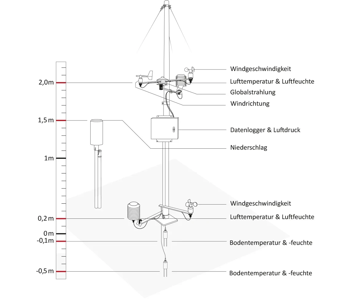

"Wald" Climate Station
- Location: Gut Frankenforst (Königswinter-Vinxel), beech, forrest
- UTM-coordinates : 373822, 5619709
- Elevation above sea level: 157 meters
- Device type: Campbell climate station with CR10X logger and multiplexer
- Operation: 2006 - 2013, 10-minute measurement interval.
- Configuration and sensors: humidity, air temperature, wind direction and speed, precipitation, soil heat flux, soil temperature, radiation balance, reflected radiation, and global radiation
- Measurement data download
Hydrological Measurement Weir
The Gut Frankenforst estate is drained by two streams: the Eichenbach and the Forstbach, which flows into the Eichenbach in the northeastern part of the estate. A Thompson weir and a multiparameter probe are installed downstream of the confluence.
- Location: Gut Frankenforst (Königswinter-Vinxel), lower reaches of the Eichenbach
- UTM-Coordinates : 0373840, 5619930
- Device type: Ott Ecolog1000 (as of 06/2025); Ott Orpheus (01/2006-08/2023
- Operation: 2006 - present, 10-minute measurement intervals.
- Measured parameters: Water level, water temperature and electrical conductivity
- Measurement data download

Climate data is avaiable in Exel format at 10-minute and daily resolutions for the "Wald" and "Wiese" climate Stations.
Daily values:
2001, 2002, 2003, 2004, 2005, 2006, 2007, 2008, 2009, 2010, 2011, 2012, 2013, 2014, 2015, 2016, 2017, 2018, 2019, 2020, 2021, 2022, 2023, 2024, 2025 (through May 27), 2025 (starting June 1), 2026 (current year, ongoing, unaudited)
1-hour values (2001-2003), 10-minute values (from 2004 onward):
2001, 2002, 2003, 2004, 2005, 2006, 2007, 2008, 2009, 2010, 2011, 2012, 2013, 2014, 2015, 2016, 2017, 2018, 2019, 2020, 2021, 2022, 2023, 2024, 2025 (through May 27), 2025 (starting June 1), 2026 (current year, ongoing, unaudited)
Contact

Sebastian Seeboth
U.028 (011)
Meckenheimer Allee 166
53115