Lehrveranstaltungen
Themen für Abschlussarbeiten
Hier finden Sie eine Liste möglicher Abschlussarbeitsthemen für Bachelor- und Masterstudiengänge. Diese Themen wurden so gewählt, dass sie die aktuellen Entwicklungen und Anforderungen in der Geomatik, insbesondere der Fernerkundung, reflektieren. Darüber hinaus sind die Studierenden aufgefordert, ein eigenes Thema für ihre Abschlussarbeit vorzuschlagen. Für weitere Informationen senden Sie bitte eine E-Mail an rsrgedu@uni-bonn.de
Lehrveranstaltungen SoSe 2024
Biospheric Impacts of Global Change Assessed by Optical Remote Sensing
Course content and structure:
Participants will form small research teams (groups of approx. 3-4 students) and work together on one of the global climate change-related topics of their own selection or provided by the lecturer. Examples of project topics are (not exclusively):
Impact of sea-level rise on islands and other coastal areas (Pacific & Asia).
Large-size river floods and their destructive impacts (Europe, Asia, Australia)
Impact of severe drought on large-scale forest diebacks (Europe & Australia),
Thawing Arctic permafrost and its impacts on land cover changes (N. America & Asia),
Assessing natural and/or societal impacts of large wildfires (N. America, Asia, Australia),
Melting and retreating of large continental glaciers (Alaska & Greenland).
The course session will include:
30-45-minute theoretical lecture introducing the state-of-the-art remote sensing techniques relevant to your projects,
short presentation by research teams outlining the status and progress of the project work, and
actual teamwork with hands-on data processing supported by the lecturer.
The last seminar session will be devoted to final presentations of teamwork achievements, followed by scientific discussions, and offers a possibility to provide feedback regarding the course structure and content. Each team is expected to produce a final report, written according to scientific communication standards. The final grade of each student will reflect the progress and final project presentations as well as quality of the final report.
The remote sensing image analyses and interpretations will be done in professional remote sensing software ENVI, QGIS, SNAP, and/or Google Earth Engine. The required software will be installed and accessible during the whole course in C-Pool at GIUB.

Kolloquium zur Masterarbeit: Scientific Structure and Methods of MSc. thesis
Course motivation and expected outcomes:
The main objective of this seminar is to acquire skills required for preparation and successful completion of the Master of Science thesis. The course will not tackle Master thesis formal aspects but will focus on scientific data processing demonstrated on Geomatic datasets with a special interest in Optical Remote Sensing. We will use lectures and discussions to learn the key steps in the process of a Master thesis execution. Specifically, we will address research methods for data acquisition and processing, including work planning and time management. After finishing this course, you will better understand research processes and should be ready to apply them to conduct the Master thesis project.
-------------------------------------------------------------------------------------------------------------------------------
Course content:
In the scientific colloquium for the Master thesis, recent Master's theses and research projects of the Remote Sensing research group will be presented and discussed. At the same time, we will look at current scientific articles and methods in applied remote sensing. Subsequently, the basics of scientific work will be discussed in the colloquium (i.e., research question formulation, hypothesis formation, project structuring, etc.) and challenges that arise when writing and working on the Master thesis will be discussed in a solution-oriented manner (i.e., measurement design, physical and statistical methods, computer programming, etc.). Furthermore, scientists from remote sensing and neighbouring disciplines from other universities and institutes will be regular guests at the colloquium. Active and regular participation in the course is expected. The preparation and presentation of a Master thesis proposal (an extended exposé) and/or a current Master's thesis or another research project is a prerequisite for successful completion of the course.

Seminar on the Bachelor Thesis (Scientific Structure and Methods of BSc. Thesis)
Course motivation and expected outcomes:
The main objective of this seminar is to learn the basic skills required for preparation and successful completion of the Bachelor of Science thesis. This includes thesis formal aspects, acquisition of input data, scientific data processing, preparation of the written version according to assessment criteria as well as work planning and time management. In addition to formal aspects, we will use lectures, discussions, and practical exercises to learn the key steps in the process and to address the questions of how a Bachelor thesis should be planned, carried out and presented. After finishing the course, you will better understand research processes and should be able to apply them to fulfil the requirements of Bachelor thesis.
-----------------------------------------------------------------------------------Course content:
In this course, we will discuss how find a suitable topic and how to define related specific research questions. Based on this, you will develop a thesis proposal (an extended exposé), in which you explain and justify your choice of topic and research questions. You will also learn how to link your research questions to relevant literature, featuring the current "state of the art", and to define the contribution of your work to the research domain. Furthermore, you will learn to prepare a synopsis outlining your chosen methods and proposing a work plan with a time schedule. You will present the synopsis in a lecture and receive further feedback, suggestions and recommendations for the conceptualization, methodology planning, and implementation of your project. Although specific Bachelor thesis proposal should be presented and discussed, a fictitious topic can also be chosen.
-----------------------------------------------------------------------------------Notes:
The supervisor of the Bachelor thesis is freely selectable, the supervision of the thesis is not bound to the seminar lecturer!
The spoken and written language of this course is English.

Optical Remote Sensing Monitoring and Applications in Practice (South-East Germany and Czech Republic)
Excursion motivation and expected outcomes:
Remote sensing detection and monitoring technologies and applications are advancing at a fast pace, getting more physically advanced, data-driven, and informative about the state of the land cover surfaces and socioeconomical processes. This 7-day excursion is designed as a practical extension of remote sensing part of the “Introduction to Geomatics” (B07) course. Participants will visit several governmental institutions, research facilities and a private company that contribute to practical use of remote sensing methods in daily life, resolving some of the current crucial societal challenges. During the 7-day journey through Czech Republic and south-east Germany (Bavaria), the participant will be presented with the state-of-the-art remote sensing sensors, related research facilities, as well as scientific lectures addressing some of the recent environmental and socioeconomical topics such as, for instance, monitoring of carbon cycle in relation to global warming, detection of bark beetle outbreaks in Czech and German coniferous forests, or practical applications of remote sensing in precision agriculture.
------------------------------------------------------------------------------------------Excursion structure and plan:
The excursion will be composed of:
Theoretical lectures featuring practical remote sensing application examples (case-studies) delivered by external experts from several institutions (research centers, universities, a private company, and German space agency - DLR),
Demonstrations of indoor remote sensing facilities, specifically, a research aircraft equipped with hyperspectral and laser scanning sensors or a DLR laboratory for calibration of optical airborne sensors,
Outdoor visits of permanent sites for monitoring carbon fluxes and other forest ecosystems processes, and educational hikes through forest ecosystems severely impacted by recent climate change induced bark beetle outbreaks.
Description:
The tentative excursion program is as follows:
Wed 22.05.2024 – Day 1: Travel from Bonn to Brno (https://en.wikipedia.org/wiki/Brno)
Thu 23.05.2024 – Day 2: Visit at CzechGlobe research institute – Research of global climate change using optical remote sensing (e.g., airplane facility https://olc.czechglobe.cz/en/flis-2/?lang=en)
Fri 24.05.2024 – Day 3: Visits of CzechGlobe ecosystem monitoring sites supporting remote sensing (e.g., ICOS station Lanzhot https://www.czechglobe.cz/en/department/ecosystem-station-lanzhot/)
Sat 24.05.2024 – Day 4: Travel from Brno to Ceske Budejovice (https://en.wikipedia.org/wiki/%C4%8Cesk%C3%A9_Bud%C4%9Bjovice) and meeting bark-beetle experts from the University of South Bohemia (e.g., Dr. Martin Hais https://www.researchgate.net/profile/Martin-Hais)
Sun 25.05.2024 – Day 5: Hiking at bark beetle outbreaks’ locations of the Sumava National Park/Bavarian Forest (https://en.wikipedia.org/wiki/%C5%A0umava_National_Park) and travelling to Munich (https://en.wikipedia.org/wiki/Munich)
Mon 26.05.2024 – Day 6: Visiting DLR remote sensing experts and facilities in Oberpfaffenhofen (e.g., calibration home base for imaging spectrometers https://www.dlr.de/eoc/en/desktopdefault.aspx/tabid-5378/9173_read-16387/)
Tue 27.05.2024 – Day 7: Visiting the Vista remote sensing company in Munich (https://www.vista-geo.de) and travelling back to Bonn
Note that this is a preliminary plan. Specific locations and program items might change depending on actual availability of external experts and accessibility of targeted places. The final program will be presented at the excursion informative meeting.
To successfully complete this module, all participants (sorted in couples by lecturer) will be asked to prepare an introductory spoken presentation (10-15 min, no slides, no visual support) on the topic related to the excursion program. Assignment of the topics will be done by lecturers two weeks before the start of the excursion. The presentation will be delivered during the travel in-between the excursion destinations (exact timing will be given by lecturer). After the excursion, all participants will conduct a multiple-choice quiz (on-line via the eCampus learning platform), featuring questions directly related to the educational content of the excursion. The minimum score to successfully conclude the excursion is 50% (i.e., at least half correctly answered questions).
The communication language during the entire excursion is English (including the presentations delivered by students and the final quiz).
The whole travel will be carried out by bus with overnights in a hotel-like accommodation. Since we will visit indoor but also few outdoor destinations, participants are expected to be equipped for short hikes in nature with hiking shoes as well as proper rain and sun protection. The estimate of expected costs covering accommodation and travel expenses (without food) is around 600€.

Optical Remote Sensing for Land Surface Mapping and Environmental Monitoring
The ongoing global climate change, mainly the increase in air temperature caused by human activities since the industrial revolution, is impacting not only natural processes and cycles but also human societies and their economic activities on a global scale. We are witnessing, for instance, unprecedently severe forest fires in the northern America, la Niña induced floods in eastern Australia, extensive thawing of permafrost in Siberia and Alaska, unexpected drying of large water bodies due to the freshwater shortage, and rapid melting of glaciers in the Arctic regions and high mountains. In this project seminar module, we will use optical remote sensing image data acquired from satellites orbiting the Earth (e.g., Copernicus/ESA’s Sentinel-2 and NASA’s Landsat-8 & 9) or from hyperspectral visible, near-infrared, and thermal images from aircrafts (e.g., airplanes) to detect, map, and potentially monitor in space and time the actual impacts of climate change specific, but not exclusive, events on the Earth surface.
Course structure
Participants will form small research teams (groups of approx. 3 students) and work together on one of the climate change-related topics of their own liking or provided by the lecturer. Examples of project topics are:
Drying of the Aral Sea and its consequent impact on local activities/land use,
Outbreaks of insect parasites, e.g., bark beetle, in mid European temperate forests,
Contribution of thawing Arctic permafrost to regional land cover changes,
Mapping impacts of Monsoon-induced floods at Asian and Australian continents,
Assessing natural and economic impacts of big forest fires in California in 2020,
Cities as summer heat islands – existing causes and potential remediations.
Weekly 4-hour courses will include:
30-45-minute theoretical lecture introducing the state-of-the-art remote sensing techniques relevant to your projects,
short presentation by a member of each research team (each week different team member) outlining the status and progress of the project work, and
actual teamwork with hands-on project work supported by the lecturer.
Course outcomes
Upon successful completion of this module, you will know how to:
find online available optical remote sensing satellite data and process it in the state-of-the-art remote sensing software,
design and execute a research project, including a proper definition of scientific hypothesis/questions, selection of appropriate optical remote sensing input data and methods, and make synthesis of analytical results answering the research questions,
write a report in accordance with the scientific standards, including proper presentation of graphical outputs (e.g., maps) and correct referencing of the relevant scientific literature (research papers, books, and conference proceedings), and
work in a team, present your intentions and results in a concise and understandable manner, receive feedback from your peers and disseminate it to improve your work and conduct an evidence-based scientific discussion.
If you have questions or need further information please contact rsrgedu@uni-bonn.de.

Remote Sensing for Mapping Drought and Insect Outbreaks in Forest Ecosystems
Forests play a crucial role in preserving our planet, as they serve as carbon sinks, absorbing CO2 and regulating the climate. Due to climate change that has largely impacted the natural ecosystems on Earth, forests are more and more threatened, not only by frequent and severe wildfires and droughts, but also by the outbreaks of insect pests such as bark beetle. In past two decades, the European forests were subjected to some of the most widespread outbreaks of Norway Spruce bark beetles, causing substantial damage. Some of the affected areas are remote and hardly accessible, making a ground assessment of the outbreak impacts difficult. In this Geomatic Method seminar, you will use multispectral remote sensing images of Sentinel-2 and Landsat satellite missions to detect the occurrence and to assess the extent of the of the bark beetle infestations in the Harz Mountain region (Germany) during the last decade.
------------------------------------------------------------------------------------
Course expected outcomes:
Upon successful completion of this course, you will know how to:
search for publicly available satellite imagery in online repositories,
use scientific literature to search for and process relevant published information,
apply satellite image processing techniques in the context of forest bark beetle outbreak detection and infested area assessment, and
extract quantitative and thematic information from satellite multispectral imagery by means of image processing and change detection techniques.
Description:
Course content and structure:
Participants will individually execute several assignment tasks. The tasks will be split into two parts:
literature work, resulting in a short (400 words max.) essay describing theoretical bases of forest bark beetle outbreaks mapping from multispectral space-borne image data, and
computer exercises, comprised of several practical tasks and relevant questions about satellite image processing methods, spectral analyses, and change detection. Python programming language will be used to process the satellite data and apply the suitable image processing methods in order to conduct these tasks. The results will be submitted to the lecturer as a report (i.e., *.PDF or *.DOCX digital document written in English).
Each 2 x 45 min seminar will consist of:
15–20-minute theoretical introduction related to the assigned task and presented by the lecturer,
5-10-minute discussion about general issues and problems related to individual tasks, and
about 65 min of individual hands-on computer work under the supervision of the lecturer.
The final mark will reflect the quality of the literature work delivered in form of an essay (30% of the overall mark) and the correctness of the satellite image analyses’ outputs and answers to questions given in the computer work part (70% of the overall mark).
-----------------------------------------------------------------------------------
Notes:
IMPORTANT: Prerequisite for participating in this course is previous successful completion of the B07 module “Introduction to Geomatic”. Successful completion of this module without the basic knowledge of satellite remote sensing is possible but will require extra workload above original expectations.
The communication language of this course is English (including the final written reports). Although English grammar and style are not part of the report evaluation, it must be written in full and understandable sentences using proper English (British or American) formulations.

Advanced Physical Geography
Im Aufbauseminar Physische Geographie werden vertiefende Einsichten in physisch-geographischen Themen und Fragestellungen sowie deren inhaltliche Verknüpfung und Ansätze zur regionalen Differenzierung vermittelt. Dies geschieht durch Seminarvorträge der TeilnehmerInnen, durch seminarbegleitende Lektüre und durch Bearbeitung von Übungsaufgaben in Einzel- und/oder Gruppenarbeit. Die Inhalte des Moduls B1 "Einführung in die Physische Geographie" werden als bekannt (und präsent) vorausgesetzt.
Neben diesen inhaltlichen Aspekten werden auch Präsentationstechniken sowie formale Gesichtspunkte bei der Anfertigung von Hausarbeiten im Seminar diskutiert. Da die erfolgreiche Teilnahme des Moduls B1 Eingangsvoraussetzung zur Seminarteilnahme ist, findet eine Vorbesprechung mit Themenvergabe am ersten Seminartermin der Vorlesungszeit im Sommersemester statt.
Veranstaltung auf Deutsch, Teilnehmer können wahlweise ihre Prüfungsleistung auf Englisch erbringen.
Advanced Physical Geography: Field Methods
Im Rahmen des Geländepraktikums werden grundlegende Kenntnisse physisch-geographischer Erhebungs- und Auswertemethoden vermittelt. Die TeilnehmerInnen führen im Gelände in Kleingruppen klimatologische, hydrologische, sowie boden- und vegetationsgeographische Erhebungen durch. Das Geländepraktikum findet im auf dem Versuchsgut Frankenforst bei Bonn statt. Neben der aktiven Mitarbeit bei den Geländearbeiten wird die Ausarbeitung eines Gruppenprotokolls erwartet. Die Anreise muss selbst organisiert werden. Eine ÖPNV-Anbindung ist gegeben.
Es entstehen keine weiteren Kosten. Anforderungen: Regelmäßige Teilnahme und Mitarbeit, Gruppenprotokoll
Ort: Gut Frankenforst
Veranstaltung auf Deutsch; Teilnehmer können das Protokoll wahlweise auf Deutsch oder Englisch verfassen.
Zeitraum: 21-25.05.2024

Introduction to GIS (QGIS) Analyses for Human Geography
In diesem Seminar werden wir uns mit den Grundlagen von Geographischen Informationssystemen beschäftigen. Mit der Open-Source-Software QGIS werden Vektor und Rasterdaten als Werkzeuge zur Erfassung, Analyse und Visualisierung räumlicher Daten verwendet. Es wird anhand von praktischen Beispielen erörtert wie die Kombination von Vektordaten und Fernerkundungsdaten zahlreiche Anwendungsmöglichkeiten in verschiedenen Bereichen wie Umweltwissenschaften, Landwirtschaft und Stadtplanung eröffnet. Wir werden uns ggf. mit der Interaktion mit der Programmiersprache Python zur Automatisierung von Arbeitsschritten beschäftigen. In einem finalen Teil des Kurses werden wir uns mit Kartengestaltung beschäftigen. Der Kurs wird aus einem theoretischen Teil bestehen in dem die Grundlagen erörtert werden und einem praktischen Teil.
Voraussetzung: Vorlesung Geomatik (B7) und Statistik (B6)
Introduction to Modern Methods in Radar and Spectral Remote Sensing
Course motivation and outcomes:
Remote sensing technologies and methodologies are advancing at a fast pace, getting more physically based, data-driven, and sophisticated. This course is designed as a continuation of Introduction to Remote Sensing Mapping and Environmental monitoring (B7). Participants will learn how to apply some of the concepts they have already studied and incorporate the actual remote sensing spectral and radar techniques to solve societal challenges. They will apply advanced classification and regression methods (e.g., machine learning), and various quantitative retrievals using hyperspectral image data, to address some of the current environmental issues.
-------------------------------------------------------------------------------------------------------------------------------
Course structure:
The communication language will be English (including the final written assignment reports).
An overview of the sensors and methods to use will be given during the first lecture, when students will also choose a topic for the 1st assignment, i.e., a literature review. The outcomes of the 1st assignment will be a 3 pages essay and a short presentation. The typical seminar lecture will have two parts: 1/ a 20-30 min long theoretical lecture related to the topic of the course, and 2/ a practical session (60-min) with hands on tasks performed on computers. Exemplary topics covered by this seminar are:
Qualitative remote sensing and emergency mapping with SAR sensors,
Time series analysis with SAR and optical sensors,
Classification with machine learning and time series,
Acquisition, calibration, and pre-processing of imaging spectroscopy data,
Quantitative remote sensing and regressions with machine learning.
Software required to perform the assignment tasks (e.g., QGIS, ENVI, SNAP, etc.) will be available during the course in ‘Geozentrum’ computer room Ü9.
Lehrveranstaltungen WiSe 2023/2024
Einführung in die Geomatik
Dieses Modul führt in die Geomatik, in Theorie und Anwendung von geo(infor)matischen Methoden ein. Es fasst die komplementä-
ren und für die Geographenausbildung zentralen methodischen Grundlagen, der Arbeit mit geographischen Informationssystemen
(GIS), Kartographie (KART) und der Fernerkundung (FE) zusammen. Es geht dabei um die Erfassung, Analyse, Modellierung und
Visualisierung raumbezogener Informationen. Dabei beschäftigt sich die FE mit der Erfassung und Auswertung von Informationen
über raumzeitliche Prozesse und Strukturen mit flugzeug- und satellitengestützten Sensorssystemen. GIS dient der Analyse und
Modellierung räumlicher Strukturen, Muster und Prozesse Die Kartographie wird in der Vorlesung unter zwei Aspekten angespro-
chen: einmal als räumliches Bezugssystem von Geodaten und zweitens als ein Methodenbaukasten zur Visualisierung von Daten
mit Raumbezug. In diesem Modul erwerben Sie die erforderlichen theoretischen, methodischen und praktischen Grundlagen, um
mit Geodaten zu arbeiten, diese fachlich kompetent zu interpretieren, zu analysieren und mittels verschiedener Softwarepaketen
die Kenntnisse praktisch anzuwenden.
Die Vorlesung besteht aus zwei parallelen Teilen mit gemeinsamen Übungen. Im ersten Teil werden die Kenntnisse zu GIS und
Kartographie vermittelt, im zweiten die zur Fernerkundung. Die Teilnehmenden bilden Arbeitsgruppen, die Übungsaufgaben ab-
wechselnd aus den Bereichen GIS/Kartographie und Fernerkundung bearbeiten. Dabei werden sie durch die Tutor:innen der Stu-
dierendenwerkstatt Geomatik unterstützt.

Einführung in GIS (QGIS) Analysen
In diesem Seminar werden wir uns mit den Grundlagen von Geographischen Informationssystemen beschäftigen. Mit der Open-Source-Software QGIS werden Vektor und Rasterdaten als Werkzeuge zur Erfassung, Analyse und Visualisierung räumlicher Daten verwendet. Es wird anhand von praktischen Beispielen erörtert wie die Kombination von Vektordaten und Fernerkundungsdaten zahlreiche Anwendungsmöglichkeiten in verschiedenen Bereichen wie Umweltwissenschaften, Landwirtschaft und Stadtplanung eröffnet. Wir werden uns mit der Interaktion mit der Programmiersprache Python zur Automatisierung von Arbeitsschritten beschäftigen und in einem finalen Teil des Kurses mit Kartengestaltung beschäftigen. Der Kurs wird aus einem theroretischen Teil bestehen in dem die Grundlagen erörtert werden und einem praktischen

Seminar zur Bachelorarbeit
Im Kolloquium wird das wissenschaftliche Arbeiten reflektiert und das Management des Projektes Bachelorarbeit diskutiert. Dies beinhaltet die begründete Auswahl eines Arbeitsthemas mit der Einbindung in eine gesellschaftsrelevante Problemstellung und einen theoretischen Kontext. Dazu gehört die Entwicklung konkreter Zielsetzungen und wissenschaftlicher Fragestellungen sowie die Bildung von Hypothesen. Hierauf basierend sind das methodische Vorgehen und ein Arbeitsplan auszuarbeiten und zu begründen. Abschließend sind die Möglichkeiten der Ergebnisinterpretation und ihr Rückbezug zu Fragestellungen, Zielsetzungen und Hypothesen zu diskutieren.
Der Betreuer bzw. die Betreuerin der Bachelorarbeit ist frei wählbar, die Betreuung der Arbeit ist nicht an den Seminarleiter gebunden. Es sollen möglichst konkrete Bachelorarbeiten vorgestellt und besprochen werden. Notfalls kann auch ein fiktives Thema gewählt werden.
Das Seminar findet alle zwei Wcohen zweistündig stat. Zu Beginn des Semesters mit der Theorie und im Laufe des Semesers dann mit freier Arbeitspahse zur Erstellung des Exposeekonzepts und Vorstellung der Exposees. Abgabe der schriftliche Fassung des Exposees: 26.01.24.

Physical Modelling and Inversion Methods in Optical Remote Sensing of Terrestrial Vegetation
The state-of-the-art remote sensing of vegetation uses data collected with various optical sensors on towers, drones, aircraft, and satellite platforms. The recent boom of data-driven machine learning algorithms (e.g., deep-learning neural networks, random forests, or Gaussian processes) allows for an efficient interpretation of such multiscale and multiresolution data, transforming the optical signals into specific information about vegetation functional traits. Yet, to be successful, this approach requires a robust and comprehensive knowledge base for i) achieving a proper training of interpretational algorithms, ii) understanding what type of optical inputs are most suitable, and iii) optimizing sensor and data technical specifications. Coupled leaf and canopy physical radiative transfer models (RTMs), simulating interactions of electromagnetic radiation within plant canopies, provide virtual environments suitable to generate such required knowledgebase.
In this course, you will learn how to map quantitative plant functional traits, such as leaf chlorophyll content, leaf water content, leaf area index, etc., from spectral satellite data (e.g., Sentinel-2) using a combination of the physical RTMs and modern machine-learning methods. Upon successful completion of this module, you will know how to:
work and pre-process the satellite spectral images of terrestrial vegetation formations,
parameterize and run in a forward mode leaf and canopy RTMs in order to simulate virtual spectral satellite observations,
train machine-learning models properly using RTMs simulated remote sensing data of the specific vegetation types (e.g., crops),
apply the machine-learning methods to quantify plant functional traits from the satellite observations, and
interpret the obtained maps, including the related uncertainty estimates.
The seminar will start with a 20-30 min long theoretical lecture related to the topic of this course. It will be followed up by a practical 'hands-on' part, where you will use the ARTMO toolbox to conduct sequentially retrieval of specific plant traits from satellite optical imagery.
Communication language (spoken as well as written): English

Remote Sensing Methods for Wildfire Landcover Change Detection
In 2016 and 2019, Australia, especially the Tasmanian island, was subjected to some of the most widespread and devastating wildfires in recent history. What made these fires so devastating is the particularly ”dense bush” type of Australian vegetation that they affected. In 2016, large areas within the Tasmania World Heritage Area and the Arthur-Pieman Conservation area were destroyed. These vegetation communities are unique and take thousands of years to regrow. Many of the affected areas are remote and largely inaccessible, making a ground assessment of the true scale of the fire devastation difficult, in some locations even impossible. In this Geomatic Method seminar, you will use multispectral remote sensing images of Sentinel-2A and Landsat-8 satellites to identify the extent of the wildfires within the Arthur-Pieman Conservation area and estimate the types and amounts of vegetation that were affected by the 2016 burn.
Participants will individually execute 12 assignment tasks. The tasks will be split into two parts:
literature work (2 tasks), resulting in a short (400 words max.) essay describing theoretical bases of forest fire mapping from multispectral space-borne image data (written preferably in English), and
computer work, comprised of 10 practical tasks and several questions about satellite image pre-processing methods (e.g., spatial and radiometric corrections), spectral analyses (e.g., automatic image classifications), and landcover change detection (e.g., basic statistics). The results will be submitted to the lecturer as a report, i.e., *.PDF or *.DOCX digital document written in English.
Each of the 2 x 45 min seminars will consist of:
15-minute theoretical introduction related to the assigned task and presented by the lecturer,
5-10-minutes of discussion about general issues and problems related to individual tasks, and
about 65 min of individual hands-on computer work under the supervision of the lecturer.
The final mark will reflect the quality of the literature work delivered in form of an essay (30% of the overall mark) and the correctness of the satellite image analyses’ outputs and answers to questions given in the computer work part (70% of the overall mark).
On successful completion of this module, you will know how to:
search for publicly available satellite imagery in online repositories,
use scientific literature to search for and process relevant published information,
apply satellite image processing techniques in the context of forest fire detection and bunt area assessment, and
extract quantitative and thematic information from satellite multispectral imagery by means of image pre-processing, classification, and change detection techniques.
The professional remote sensing software ENVI will be used in this module for computer-based work. The basic functionality of this software, i.e., loading and displaying an image with different spectral band combinations, image composition contrast enhancement, plotting of spectral signatures, work with regions of interest (ROIs), application of required image analyses, and export of images and plots suitable for inclusion in your assignment report, will be explained during first seminar sessions. Previous knowledge about remote sensing image processing will be to your advantage.
If you have questions or need further information please contact rsrgedu@uni-bonn.de.
Geomatik - Koordination Studierwerkstatt
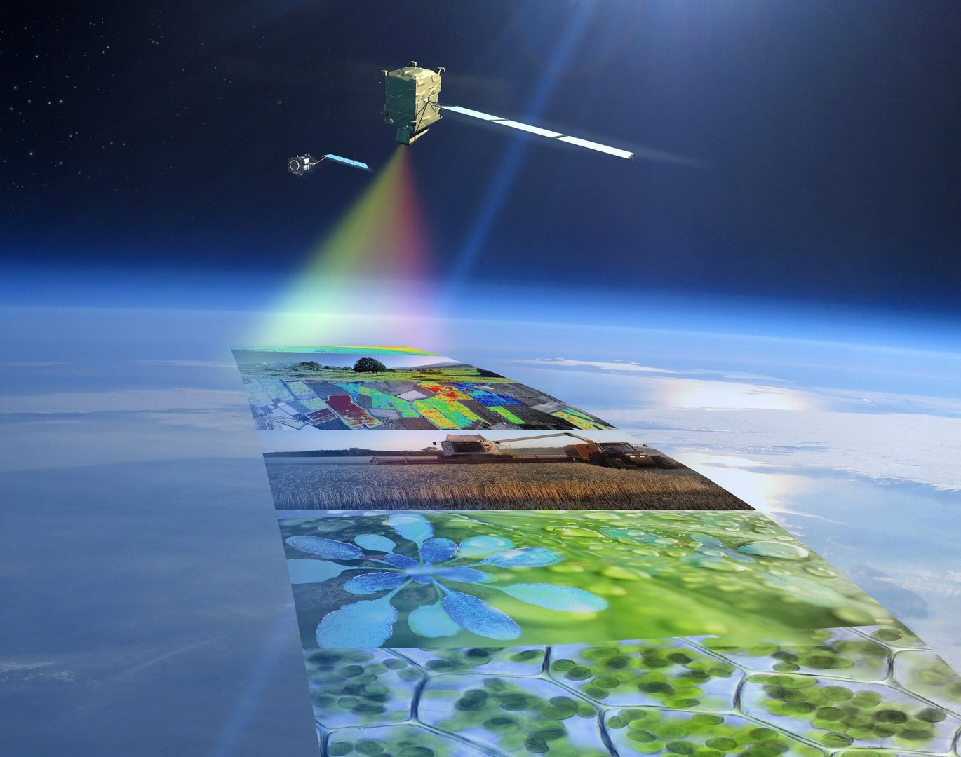
Optical remote sensing for eco-physiological modelling of terrestrial vegetation ecosystems
Course motivation and content:
In the Anthropocene era, impacted by a man-caused global warming due to excessive CO2 emissions, computer models simulating and forecasting temporally dynamic eco-physiological processes of terrestrial vegetation, such as carbon uptake or evapotranspiration, are essential for a ‘carbon neutral’ economy and a ‘carbon reducing’ management of natural ecosystems. Optical remote sensing provides multitude of input data for dynamic land surface vegetation modelling, spanning from categorical maps of land cover classes to spatially explicit quantitative estimates of vegetation biochemical and physical traits such as: fraction of absorbed photosynthetic radiation, leaf area index, or contents of water, photosynthetic foliar pigments, and nitrogen. This remotely sensed information, retrieved from air-/space-borne spectral and thermal sensors, is getting more accurate and more frequent thanks to the improving sensing technology (e.g., hyperspectral imaging spectroscopy), a higher number of satellite constellations (e.g., new Sentinel and future Chime ESA satellites), and newly available optical signals like, for instance, sun-induced chlorophyll fluorescence (retrievable from NASA’s OCO-2/3 and ESA’s TROPOMI and future FLEX missions). This course is designed to enlarge knowledge and deepen understanding of M.Sc. students about actual and near future optical vegetation remote sensing products that can be assimilated by existing eco-physiologically based land surface vegetation models, such as ORCHIDEE, JULES or LPJ-GUESS. The knowledge gained in this course is essential for future study climate change related topics and useful for work in fields of precision agriculture, forest monitoring and natural ecosystems’ management.
Course structure:
To comprehend advanced approaches for quantitative estimations of vegetation traits from Earth observations, the course participants will learn how the solar electromagnetic radiation interacts with individual plant leaves and canopies, what are the main pre-processing and remote sensing image interpretation methods, and how are the obtain maps of vegetation traits assimilated by the land surface vegetation models.
The seminar will be split into three thematic parts:
Remote sensing observations: Acquisition, calibration, and pre-processing of leaf and canopy spectral measurements data.
Interpretation methods: Methods for retrieval of vegetation traits from satellite spectral measurements.
Dynamic vegetation models: Assimilation of remote sensing products in selected land surface vegetation models.
The seminar will contain theoretical lectures (45-min per week) delivered by the lecturer and computer-based practical exercises (for instance, spectroscopy of vegetation leaves and canopies) performed by the course participants. A multiple-choice test will be carried out upon the completion of each thematic part. The final grade of each seminar participant will be deduced from correct answers of tests and computer exercises.
Course outcomes:
On successful completion of this module, students will be able to:
Understand how optical remote sensing can inform models predicting vegetation functioning within the carbon and water cycles.
Find and assess quality of remotely sensed maps of vegetation traits relevant for eco-physiological modelling.
Use/assimilate vegetation remote sensing product in to the dynamic land surface vegetation models in order to predict, for instance, vegetation carbon assimilation capacity or water use efficiency.
Language of communication (both oral and written) is English.
Optical Remote Sensing for Land Surface Mapping and Environmental Monitoring
Course motivation
The ongoing global climate change, mainly the increase in air temperature caused by human activities since the industrial revolution, is impacting not only natural processes and cycles but also human societies and their economic activities on a global scale. We are witnessing, for instance, unprecedently severe forest fires in the northern America, la Niña induced floods in eastern Australia, extensive thawing of permafrost in Siberia and Alaska, unexpected drying of large water bodies due to the freshwater shortage, and rapid melting of glaciers in the Arctic regions and high mountains. In this project seminar module, we will use optical remote sensing image data acquired from satellites orbiting the Earth (e.g., Copernicus/ESA’s Sentinel-2 and NASA’s Landsat-8 & 9) or from hyperspectral visible, near-infrared, and thermal images from aircrafts (e.g., airplanes) to detect, map, and potentially monitor in space and time the actual impacts of climate change specific, but not exclusive, events on the Earth surface.
Course structure
Participants will form small research teams (groups of approx. 3 students) and work together on one of the climate change-related topics of their own liking or provided by the lecturer. Examples of project topics are:
Drying of the Aral Sea and its consequent impact on local activities/land use,
Outbreaks of insect parasites, e.g., bark beetle, in mid European temperate forests,
Contribution of thawing Arctic permafrost to regional land cover changes,
Mapping impacts of Monsoon-induced floods at Asian and Australian continents,
Assessing natural and economic impacts of big forest fires in California in 2020,
Cities as summer heat islands – existing causes and potential remediations.
Weekly 4-hour courses will include:
30-45-minute theoretical lecture introducing the state-of-the-art remote sensing techniques relevant to your projects,
short presentation by a member of each research team (each week different team member) outlining the status and progress of the project work, and
actual teamwork with hands-on project work supported by the lecturer.
Course outcomes
Upon successful completion of this module, you will know how to:
find online available optical remote sensing satellite data and process it in the state-of-the-art remote sensing software,
design and execute a research project, including a proper definition of scientific hypothesis/questions, selection of appropriate optical remote sensing input data and methods, and make synthesis of analytical results answering the research questions,
write a report in accordance with the scientific standards, including proper presentation of graphical outputs (e.g., maps) and correct referencing of the relevant scientific literature (research papers, books, and conference proceedings), and
work in a team, present your intentions and results in a concise and understandable manner, receive feedback from your peers and disseminate it to improve your work and conduct an evidence-based scientific discussion.
Introduction to Remote Sensing Time Series Analysis
Course motivation and content:
With the increasing availability of satellite imagery, time series of remotely sensed datasets are now widely used to monitor various aspects of the Earth environment, including land surfaces, open water and atmosphere, and their interactions with human activities under the on-going global climate change.
Recently, Google Earth Engine (GEE) has become one of the most widely used tools in processing long-term satellite observations time series for scientific as well as policy-making purposes. GEE provides free access to large-scale data analysis using an online ‘cloud’ computing technology. Its Java language-based interface allows users to access and analyze satellite image data without the need for local storage or software installation.
This seminar will focus on time series analysis using the GEE Code Editor, by combining theoretical lectures with practical ‘hands-on’ programming exercises.
Course structure:
Participants will work individually or in pairs on weekly topics related to their specific areas of interest. These topics will focus on the analysis of time series data to monitor, detect, or provide insight into the following topics:
- Variation of water surface areas to assess the impact of drought and flood events and to analyze the frequency of these events over a given period.
- Temporal changes of different land cover types, including agricultural areas, evergreen forests, urban areas, and water bodies.
- Changes in forest areas assessing deforestation of the evergreen forest region.
- Change of agricultural area due to factors such as limited water supply, heat waves, and other relevant environmental impacts.
- Monitoring of urban area to observe urban expansion over time.
- Seasonal changes in an evergreen forest area, based on vegetation spectral indices, to investigate a relationship with an increasing pressure of the climate change.
- The impact of coal mining on productive agricultural landscapes.
- Dense time series analysis using the Breaks For Additive Season & Trend (BFAST) software toolbox.
Weekly 2-hour courses will include:
- 30-45 minute theoretical lecture introducing the state of the art of remote sensing time series data and analysis methods.
- After the lecture, students will be provided with a step-by-step (function-by-function) guide to programming in GEE, including sample JavaScripts to perform pre-defined GEE analyses.
Course outcomes:
On successful completion of this module, students will be able to:
- Select appropriate time series remote sensing input data, pre-processing method, and analysis methods.
- Pre-process satellite data timeseries by mastering smoothing, filtering, and filling missing data techniques.
- Programming with JavaScript in GEE.
- Carry out remote sensing analysis quality assessment, such as, collecting reference data and cross-validation to assess the accuracy and reliability of the analysis.
Language of communication (both oral and written) is English.
Software used in this course: https://earthengine.google.com/#!/ Specific study literature will be recommended by lecturer during the seminar lectures
Quantitative Remote Sensing of Land Surface Processes

Einführung in die Nutzung von Cloud-Plattformen zu Analysen in der Physischen Geographie
In diesem Seminar werden verschiedene Aspekte zur Nutzung von Cloud Plattformen, deren Datenangebot und Schnittstellen vorgestellt. Ein Focus wird hierbei auf Applikationen zum Einsatz von Satellitendaten, insbesondere von Daten des Copernicus Programms der Europäischen Raumfahrtagentur (ESA), liegen. Es wird ebenso die Nutzung der Daten der Copernicus Kerndienste (Landüberwachung, Meeresumwelt, Atmosphäre, Klimawandel, Katastrophen- und Krisenmanagement und Sicherheit) vorgestellt.
Die nationalen Plattformen CODE-DE und EO-Lab, wie auch das europäische Copernicus DataSpace Ecosystem (CDSE) werden für Applikationen genutzt, wie auch die Google Earth Engine.
Das Seminar baut auf einem ersten theoretischen Teil auf, bei dem auch die für das Seminar relevanten Grundlagen der Fernerkundung wiederholt werden. Im einem zweiten Teil sollen existieren Daten-Dienste vorgestellt werden, sowie in einem dritten Teil der Einstieg in das Cloud basierte Arbeiten mit Satellitendaten erfolgen.
Kolloquium zur Masterarbeit
Im wissenschaftlichen Kolloquium zur Masterarbeit werden laufende Masterarbeiten und Forschungsarbeiten am Zentrum für Fernerkundung der Landoberfläche (ZFL) https://www.zfl.uni-bonn.de/ und der Arbeitsgruppe Fernerkundung (RSRG) am Geographischen Institut vorgestellt und diskutiert. Begleitend setzen wir uns mit aktuellen wissenschaftlichen Aufsätzen und Methoden der Erdbeobachtung und Themen des Raumfahrtmanagements auseinander. Anhand der Master-/Forschungsarbeiten und Zeitschriftenartikel werden die vielfältigen Aspekte des wissenschaftlichen Arbeitens erarbeitet (Fragestellung, Hypothesenbildung, Aufbau/Struktur, etc.).
Es ist geplant, dass regelmäßig externe Wissenschaftler*innen aus Nachbardisziplinen und von anderen Universitäten und Instituten zu Gast im Kolloquium sein werden. Anhand der Vorträge werden verschiedene aktuelle Forschungsthemen, wissenschaftliche Fragestellungen und Herangehensweisen aus der Erdbeobachtung veranschaulicht.
Von den Teilnehmer*innen der Lehrveranstaltung wir eine aktive und regelmäßige Teilnahme, die Ausarbeitung eines Exposées für die Masterarbeit sowie die Präsentation der laufenden Masterarbeit oder einer anderen Forschungsarbeit erwartet.
Das Seminar findet alle zwei Wochen zweistündig statt.
Lehrveranstaltungen SoSe 23
Biospheric impacts of global change assesed with optical remote sensing
Level: Master
Kurs: M4 Projektseminar
Credits: 18LP - 6SWS
The ongoing climate change, namely the increase in air temperature caused by human activities since the industrial revolution, is impacting not only natural processes and cycles but also human societies and their economics on a global scale. We are witnessing, for instance, unprecedently severe forest fires in the northern hemisphere and Australia, extensive thawing of permafrost, unexpected drying of large water bodies due to the freshwater shortage, rapid melting of glaciers in the Arctic regions and high mountains. In this project seminar module, we will use optical remote sensing image data acquired from satellites (e.g., Copernicus/ESA’s Sentinel-2 and NASA’s Landsat-8) or aircraft (hyperspectral visible, near-infrared, and thermal images) to detect and map the actual impacts of some of the climate change events in space and time.
Upon successful completion of this module, you will know how to:
- design and execute a research prokject, including a proper definition of scientific hypothesis/questions, selection of appropriate optical remote sensing input data and processing methods, and make a synthesis of analytical results answering the research questions
- work efficiently with optical remote sensing image data and state-of-the-art image processing software,
- write a scientific report in accordance with current standarts, inclduing proper presentation of graphical outputs (e.g. maps) and correct referencing of the relevant scientific communications, and
- work in a team, present your intentions and results in a concise and understandable manner, recieve feedback from your peers and disseminate it to improve your work, and conduct an evidence-based scienitifc discussion.
The remote sensing image analyses and interpretaions will be done in a professional remote sensing software ENVI (QGIS might be considered). A basic understanding of remote sensing image processing is required.

Remote sensing of wildfire impacts
Level: Master
Kurs: M2 Forschungsmethoden
Credits: 6LP - 2SWS
In 2016 and 2019, Australia, especially Tasmania, was subjected to some of the most widespread and devastating forest fires in recent history. What made these fires so devastating is the particularly “dense bush” type of Australian vegetation they affected. In 2016, large areas within the Tasmania World Heritage Area and the Arthur-Pieman Conservation area were destroyed. These vegetation communities are unique and take thousands of years to regrow. Many of the affected areas are remote and largely inaccessible, making proper assessment of the true scale of the fire devastation difficult. For this Geomatic Method seminar, you will use multispectral remote sensing images of Sentinel-2A and Landsat-8 satellites to identify the extent of the blaze within the Arthur-Pieman Conservation area and estimate the types and amounts of vegetation affected by the 2016 burn.
On successful completion of this module, you will know how to:
- search for publicly available satellite imagery in the online repositories,
- use scientific literature to search for and process relevant published information,
- apply satellite image processing techniques in the context of forest fire detection and bunt area assessment, and
- extract quantitative and thematic information from satellite multispectral imagery by means of image pre-processing, classification, and change detection techniques.
In this module, the professional remote sensing software ENVI will be used for computer-based work. The basic functionality of this software, i.e., loading and displaying an image with different spectral band combinations, image composition contrast enhancement, plotting of spectral signatures, work with regions of interest (ROIs), application of required image analyses, and export of images and plots suitable for inclusion in your assignment report, will be explained (if needed) during this module. Previous knowledge about remote sensing image processing will be to your advantage.

Introduction to modern methods of optical remote sensing
Level: Bachelor
Kurs: B8 I/II Forschungsmethoden
Credits: 6LP - 2SWS
Remote sensing technologies and methodologies are advancing at a fast pace, getting more physically based, data-driven and sophisticated. This course is designed as a continuation of Introduction to Remote Sensing Mapping and Environmental monitoring (B7). Participants will learn how to apply some of the concepts they have already studied and incorporate the actual remote sensing spectral and radar techniques to solve societal challenges. They will apply advanced classification and regression methods, such as machine learning, and various quantitative retrievals from hyperspectral image data, to solve some of the current environmental and scientific problems.

Introduction to remote sensing environmental mapping and monitoring
Level: Bachelor
Kurs: B11 Projektseminar
Credits: 12LP - 4SWS
The ongoing global climate change, mainly the increase in air temperature caused by human activities since the industrial revolution, is impacting not only natural processes and cycles but also human societies and their economic activities on a global scale. We are witnessing, for instance, unprecedently severe forest fires in the northern America, la Niña induced floods in eastern Australia, extensive thawing of permafrost in Siberia and Alaska, unexpected drying of large water bodies due to the freshwater shortage, and rapid melting of glaciers in the Arctic regions and high mountains. In this project seminar module, we will use optical remote sensing image data acquired from satellites orbiting the Earth (e.g., Copernicus/ESA’s Sentinel-2 and NASA’s Landsat-8 & 9) or from hyperspectral visible, near-infrared, and thermal images from aircrafts (e.g., airplanes) to detect, map, and potentially monitor in space and time the actual impacts of climate change specific, but not exclusive, events on the Earth surface.
Lehrveranstaltungen WiSe 22/23
B7 Geomatik - Teilbereich Fernerkundung
Schwerpunkte im Teilbereich Fernerkundung:
- Theoretische und physikalische Grundlagen der FE
Aufnahmesysteme: Sensoren, Plattformen, Bildformate - Aufbereitung und inhaltliche
Auswertung von Satellitendaten - Fallbeispiele für geographische Anwendungen (z.B. Landnutzungsänderungen,
Städtewachstum, Landdegradation, Gletscherschmelze)
Qualifikationsziele im Teilbereich Fernerkundung:
- Kenntnisse in die physikalischen Grundlagen der Fernerkundung (FE)
- Kenntnisse in der visuellen Bildinterpretation und in der
- Aufbereitung von
digitalen Satellitendaten - Kenntnisse in der inhaltlichen Auswertung von FE-daten (z.B. Bildklassifikation,
Veränderungsdetektion, Zeitreihenanalyse)
Modelling and Inversion Methods of Optical Remote Sensing Observations of Terrestrial Vegetation
In this course, you will learn how to map quantitative plant functional traits, such as leaf chlorophyll content, leaf water content, leaf area index, etc., from spectral satellite data (e.g., Sentinel-2) using a combination of the physical RTMs and modern machine-learning methods. Upon successful completion of this module, you will know how to:
- work and pre-process the satellite spectral images of terrestrial vegetation formations
- parameterize and run in a forward mode leaf and canopy RTMs in order to simulate virtual spectral satellite observations,
- train machine-learning models properly using RTMs simulated remote sensing data of the specific vegetation types (e.g., crops),
- apply the machine-learning methods to quantify plant functional traits from the satellite observations, and
- interpret the obtained maps, including the related uncertainty estimates.
Introduction to Remote Sensing Mapping and Environmental Monitoring
Growing human population density combined with the ongoing climate change, both taking place on a global scale, are increasing pressure on the Earth's resources and services provided by ecosystems all over the World. Appropriate management and adequate solutions to environmental problems, such as deforestation, overgrazing, soil contamination and depletion, and water shortage, are heavily dependent on accurate and timely knowledge. To work collaboratively with experts from multiple disciplines, planners, managers, policymakers, and researchers require a comprehensive understanding of the complex factors involved in processes driving the environmental problems and challenges. Here, remote sensing data and their interpretation play a central role in the quest for required knowledge.
Participants will form small research teams (groups of approx. 3 students) and work together on one of the climate change-related topics of their own liking or provided by the lecturer. The module will be split into two parts: I) a block of morning and afternoon intensive sessions (4 + 4 SWS between 9.00 and 17.00 hrs) from 10 until 14 October 2022, and II) a morning session each second week from 20 October 2022 till 02 February 2023.
Upon successful completion of this module, you will know how to:
- design and execute a research project, including a proper definition of scientific hypothesis/questions, selection of appropriate optical remote sensing input data and processing methods, and make a synthesis of analytical results answering the research questions,
- work efficiently with optical remote sensing image data and the state-of-the-art image processing software,
- write a scientific report in accordance with the current standards, including proper presentation of graphical outputs (e.g., maps) and correct referencing of the relevant scientific communications (research papers, books, and conference proceedings), and
- work in a team, present your intentions and results in a concise and understandable manner, receive feedback from your peers and disseminate it to improve your work and conduct an evidence-based scientific discussion.
Writing BSc. or MSc. Thesis at RSRG
Wenn Sie Interesse haben eine Bachelor- oder Masterarbeit im Bereich Fernerkundung zu schreiben, wenden Sie sich bitte an Vanessa Spitzer um einen Termin mit Prof. Malenovský zu vereinbaren.
Bringen Sie gerne direkt eigene Themenvorschläge mit. Alternativ kann ein Thema auch im Gespräch mit Prof. Malenovský gefunden werden.
Kontakt:
Für Anfragen bezüglich Lehrveranstaltungen wenden Sie sich bitte an:
rsrgedu@uni-bonn.de
Für Anfragen bezüglich Forschung und Projekten wenden Sie sich bitte an:
rsrgsci@uni-bonn.de